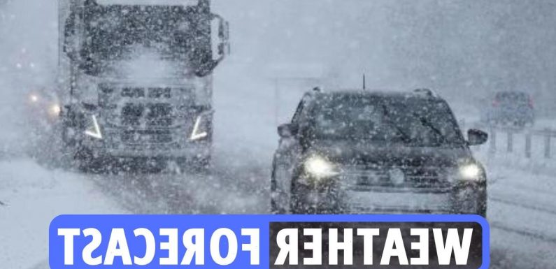
STORM Dudley is expected to unleash havoc on Britain this week with fears gale-force winds will rip roofs off homes and cut power.
Brits wrapped up warm during a wet and windy weekend which brought heavy rain and even some flooding.
And the misery continues with five Met Office weather warnings and two named storms in place for this week – covering Scotland, Northern Ireland, and the whole of England.
On Wednesday, the dangerously strong winds of Storm Dudley will strike – the fourth named storm of the winter.
Meanwhile, weather modelling maps, WX Charts, show Brits should start preparing for arctic conditions – with almost the entirety of the UK set to see snow.
Read our weather live blog for the latest news and forecasts…
- Louis Allwood
Storm Eunice
Covering the entirety of Wales, England, Northern Ireland, and southern Scotland, Storm Eunice will hit in the early hours of Friday and will continue until 9pm.
Eunice is also classed as a "danger to life" weather warning – bringing 80mph winds, snow, and blizzard conditions.
The warning states: "Storm Eunice is likely to affect the UK on Friday bringing a period of very strong winds that could cause significant disruption.
"There is a small chance that flying debris will result in a danger to life, with fallen trees, damage to buildings and homes, roofs blown off and power lines brought down.
"There is a small chance that injuries and danger to life could occur from large waves and beach material being thrown onto sea fronts, coastal roads and properties."
- Louis Allwood
Amber warning for Wednesday and Thursday
The Met Office have released an Amber weather warning for very strong westerly winds that are expected to develop across western Scotland and northern Northern Ireland.
The warning is for late Wednesday and will extend eastward across southern Scotland and northern England during the evening.
There is still some uncertainty in the timing and location of the strongest winds but there is the potential for inland wind gusts of 70-80 mph in places.
Gusts of 80-90 mph are possible around exposed coasts and hills.
- Louis Allwood
Storm Dudley set to cause travel chaos
Brits have been warned that road, rail, air and ferry services are set to be affected in the turbulent gales – with some roads and bridges potentially closing.
And there's a chance of injuries and danger to life from flying debris as the country battles the blistering 90mph westerly winds.
Along with the intense wind, stormy weather and downpours are expected to stir in the UK until Sunday.
But the gales aren't the only severe weather Brits will have to face this week – with snowfall on the cards from Wednesday onwards.
Parts of Scotland are being braced for snow – which could last nearly EIGHT days.
- Louis Allwood
Storm Dudley to hit this week
STORM Dudley could batter Britain this week as blistering gales of 90mph are expected to hit with eight DAYS of snow on the cards.
Brits will face power cuts and danger to life warnings later this week – and the storm will be named if the severe weather triggers an amber or red weather warning.
There are currently weather warnings in place for Wednesday and Thursday – covering Scotland, Northern Ireland, and parts of northern England.
But the dangerously strong winds could turn into Storm Dudley – Britain's fourth named storm of the winter – if weather officials upgrade the severity before Wednesday.
The Met Office said: "There will be very strong winds at times, especially in the north. It will be a very unsettled week.
"Tuesday has unsettled weather for many, with rain, before a deep low-pressure system on Wednesday. It will be closely watched as it brings wet and windy conditions.
"And the changeable theme continues with further spells of wet and windy weather. Conditions will be colder at times in the north, with wintry showers."
- Louis Allwood
Manchester will see sunny spells this afternoon
A cloudy and fairly wet morning with showery rain, locally heavy at times.
Brief sunny intervals by the afternoon, but isolated showers continuing. Brisk north-westerly winds, especially in coastal areas. Maximum temperature 8 °C.
Becoming dry and cold this evening with skies clearing.
Temperatures rising later overnight as strengthening winds and heavy rain arrives, this briefly preceded by some snow over the northern Pennines. Minimum temperature 0 °C.
- Louis Allwood
Cloudy start for those in Edinburgh
A cloudy start with last of overnight rain soon dying out, then a drier and brighter day with sunny spells.
Still a few showers, more especially this afternoon across Lothians and Borders. Rather cold. Maximum temperature 7 °C.
Dry for much of the night with clear periods and widespread frost.
Temperatures recovering later tonight as a band of rain comes across from west. Minimum temperature -1 °C.
- Louis Allwood
London forecast for today and tonight
A bright start for most with some sunshine, then increasingly cloudy and breezy, with outbreaks of rain moving gradually southeast.
Temperatures mainly near average, perhaps locally mild. Maximum temperature 10 °C.
Cloud and rain clearing eastwards during the evening, then generally clear skies overnight, with a slight frost possible.
Cloud increasing around dawn. Minimum temperature 1 °C.
- Milica Cosic
Today's weather forecast
Rain across northern England and Scotland will clear eastwards during the morning.
Most areas will then be dry and bright with long spells of winter sunshine however there is a chance of showers and these may be wintry across northern Britain.
Variable amounts of cloud will linger in the south.
- Milica Cosic
More wintry weather for Monday
Mercury will plunge today, dipping close to freezing in eastern and south-eastern England.
Rain will also bucket down for many, making for pretty miserable conditions.
And the cold, wet snap means truly wintry weather come Monday – just in time for the most romantic day of the year.
Weather charts show temperatures plunging to -3C in Scotland overnight, rising to a measly 4C during the day.
Meanwhile in England Brits will have to endure highs of 6C in Newcastle, 7C in Nottingham and 8C in London.
- Milica Cosic
Wrap up warm for Valentine's Day tomorrow
VALENTINE'S Day plans could be frozen as Brits brace for a whiteout February 14.
Netweather forecaster Jo Farrow added: "Something colder, briefly, for Monday with more snow showers for northern Scotland.
"Then we’ll be watching a developing low pressure moving in from the Atlantic for the middle of next week.
"With a strong jet core powering across the Atlantic, it could turn stormy here."
- Milica Cosic
Long rage forecast for February 17 – 26
The Met Office’s long forecast for February 17 – 26 warns of “wintry conditions”.
They said: “Some short lived cold spells could bring some brief periods of snow.”
WX charts predict that the North East will see one of two centimetres on February 20.
Meanwhile Northern Ireland will see two centimetres of the white stuff.
But the brunt of the storm will hit the Scottish Highlands, where temperatures will plummet as low as -10 – and 10 or more inches of snow will fall.
- Milica Cosic
UK weather outlook for Tuesday and Wednesday
On Tuesday a band of cloud and rain will track south-eastwards across the country and will be locally heavy before clearing to reveal showers, some wintry.
Wednesday will bring another unsettled and overcast day with cloudy skies and rain tracking north-eastwards which will be locally heavy.
- Milica Cosic
Exact date ’10-inch snowbomb’ will hit
FORECASTERS have revealed the exact date a 10 inch snowbomb will hit the UK with a -10C storm set to engulf Britain.
Weather modelling maps show Brits should start preparing for arctic conditions – with almost the entirety of the UK set to see snow.
WX Charts show the storm will move in from the west next Sunday February 20 – and will continue into the following week.
In the meantime Valentine’s Day plans could be frozen as Brits brace for a whiteout February 14.
But lovers are in for lashings of rain and gale-force winds before the snow comes down.

- Milica Cosic
Explained: How should you prepare for safe driving in snow?
Before heading off in the snow, plan your journey carefully and keep up-to-date with local weather reports.
Also:
- Allow more time than you usually would and ensure all the snow is clear from your vehicle.
- It is actually against the law to drive with snow on your car.
- Carry a lock de-icer with you to clear your locks.
- Make sure any auto wiper control is switched off before turning the ignition on.
- If they are frozen to the screen the control fuse will blow.
- Check your tyres for adequate tread so the grip is sufficient. If conditions are very bad you may want to consider using snow socks or chains.
- Use a good screenwash that protects down to at least -35C to prevent the water from freezing.
Being gentler on the throttle and brakes and slowing down, particularly on rural or ungritted routes, can help ensure a safe and trouble-free journey, advises the RAC.
Snow for 12 DAYS expected
A NEW map has shown the UK will be hit with snow for 12 DAYS as an Arctic blast brings "23 INCHES" of the white stuff.
Flurries are expected across the country, starting in Scotland today and spreading south into next week – with temperatures hitting a chilly -7 in parts.
On February 16, vast swathes of the west coast down to Cornwall will see flurries too, before the snow continues towards the end of the month.
- Milica Cosic
Early March will be mild
This period is likely to see a continuation of changeable conditions with systems arriving from the Atlantic, although perhaps becoming drier in many areas with most of the rain confined to the far north and northwest.
Many areas remaining windy but less so in the south, with gales likely in the far north and northwest.
Largely mild with the chance of some brief colder spells between systems.
- Milica Cosic
Driving tips for the cold weather months
- Six things drivers need to know about driving in snow and ice
- Why won’t my car start in the cold weather?
- Eight things to keep drivers safe from snow
- Seven dos and don’ts for driving in ice and snow
- Drivers urged to check car batteries during the colder months
- Warming up your car can be bad for your engine
- Five essentials to pack before heading out on wintery roads
- Can you drive on black ice?
The chilliest regions that got cold weather payments
THOUSANDS of residents in three of the coldest parts of Great Britain have received £25 government payouts seven times during the winter as temperatures plunged below zero.
Government data has revealed the British regions where most Cold Weather Payments payments have been made so far this year – is your area included?
Here are the coldest regions where seven Cold Weather Payments have been made so far this year:
Braemar:
- Angus
- Perth and North Perthshire
- West Aberdeenshire and Kincardine
Number eligible for payment: 1,000
Loch Glascarnoch:
- Caithness
- Sutherland and Easter Ross
- Inverness
- Nairn
- Badenoch and Strathspey
- Ross
- Skye and Lochaber
Number eligible for payment: 1,000
Tulloch Bridge:
- Argyll and Bute
- Inverness
- Nairn
- Badenoch and Strathspey
- Paisley and Renfrewshire North
- Perth and North Perthshire
- Ross
- Skye and Lochaber
- Stirling
Number eligible for payment: 2,000
Rainy start to this week for Londoners
Monday a band of rain moves southeast. Tuesday frosty start before rain arrives, then isolated showers following.
Wednesday milder but windy with coastal gales, largely cloudy with patchy rain.
February to be 'snowiest month of the year'
FEBRUARY is looking set to be the "snowiest month of the year" as temperatures plummet across the UK.
The icy snap is set to strike on Friday when the mercury will plunge to a bone-chilling -10C.
It will be particularly glacial in parts of Scotland where forecasters predict widespread lows of -8C and the possibility of -10C, according to WXCharts.
The chilly conditions will bring bucketloads of snow, with a whopping 23 inches expected on the ground in Scotland by February 11.
Long range forecast for February 23 – March 9
Through the end of February, the unsettled weather is likely to continue. Lower pressure to the north and higher pressure to the south will result in westerly winds off the Atlantic.
Low pressure is likely to be in charge at first however, meaning showers or longer spells of rain for many parts of the UK, but especially the north, and strong winds too.
The driest conditions will probably be in the south.
Heading into March, the high pressure to the south may begin to build northwards, with an increasing chance of dry conditions spreading further north, with the most unsettled conditions increasingly confined to the far north.
Temperatures are most likely to be above average.
- Milica Cosic
Who is eligible for Cold Weather Payments?
You can get the cash if you are on one of the following benefits:
- Pension Credit
- Universal Credit
- Income Support
- income-based Jobseeker’s Allowance
- income-related Employment and Support Allowance
- Support for Mortgage Interest
Depending on your specific circumstances, you may also need to meet one or more of the following additional criteria:
- Have a disability or be in receipt of pension premium
- Have a child who is disabled
- Be in receipt of child tax credit that includes a disability or severe disability element
- Have a severe or enhanced disability premium
- Be in receipt of a limited capability for work amount
- Have a child under five living with you
You can find out more about eligibility on the government's website.
If you're eligible, you should get the payments automatically within 14 days of the weather reaching the low temperature.
It should be sent into the same account where you get your benefit payments.
But if you think you should get the payment and haven't, then contact your pension centre or Jobcentre Plus office, or call the Universal Credit helpline on 0800 328 5644.
Tonight's weather
Dull and damp during the evening with grey skies and outbreaks of rain which will ease and clear eastwards.
Much of southern and central England will then become dry with clear spells however further north will continue unsettled with outbreaks of rain which will be heavy and persistent at times.
Cloudy and wet morning for those in Manchester tomorrow
A cloudy and fairly wet morning with showery rain, locally heavy at times. Brief sunny intervals by the afternoon, but isolated showers continuing.
Brisk north-westerly winds, especially in coastal areas. Maximum temperature 8 °C.
Tuesday to Thursday outlook for London
Tuesday starting rather wet and windy, perhaps drier later. Becoming windy from midweek, perhaps with gales in prone spots.
Mild and mainly cloudy by this time, with occasional rain.
Source: Read Full Article
