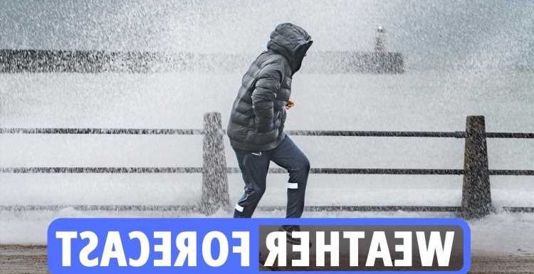
THE Met Office issued fresh danger to life warning as Storm Corrie brought 92mph winds to the UK – just hours after Malik wreaked deadly havoc.
Severe gusts have left 30,000 people without power in Scotland on top of the 7,000 who were already cut off as a result of Storm Malik.
Northern Powergrid says there are an additional 4,000 people in Northumberland, Tyne and Wear and County Durham without power today.
The chaos comes just hours after Storm Malik killed two people.
Yesterday, a nine-year-old boy became Storm Malik's second victim after he was crushed to death by a tree – after a woman, 60, was killed in Scotland.
The tree toppled down on the youngster – who was with an elderly relative who suffered a head injury – shortly after 1.10pm in Tean, Staffs, on Saturday afternoon.
Read our weather live blog for the latest news and forecasts…
- Louis Allwood
Odds on February to be coldest on record
Next month could be the coldest February on record, according to Ladbrokes.
The bookies now make it just a 3/1 shot for the coldest February EVER to be recorded this year, with temperatures soon set to tumble.
Odds of 2/1 says this ends up being the coldest winter since records began.
Alex Apati of Ladbrokes said: “With a big freeze set to batter all four corners of the UK, the odds suggest we’re in for some record-breaking low temperatures in the coming weeks.”
- Louis Allwood
Snowstorm could continue until at least February 11
Met forecaster James Madden explained cold and snow will approach from the north during the beginning of the month, with wintry downpours potentially reaching the capital.
Long-range predictions are suggesting that snow could fall in northern regions if the freezing temperatures continue.
A snowstorm could continue until at least February 11, according to forecasts, after parts of the country are soaked by rain and the white stuff.
- Joseph Gamp
Scotland to see a blustery start to the morning
The Met Office has this evening place a yellow weather warning for wind across a large part of north and north-eastern Scotland.
The weather agency tweeted: "Tuesday will get off to a very blustery start across Scotland with sunshine and showers.
"Elsewhere it will be mainly cloudy with patchy rain."
- Joseph Gamp
Is there a difference between male and female storms?
A study of American hurricanes has shed light on an alarming pattern and explained that more people are killed by "female" storms than those with male names.
The reason why is all down to how we subconsciously view gender, since we're more likely to assume that storms with female names will be less dangerous. This means people end up taking fewer precautions to protect themselves, according to researchers at the University of Illinois.
Incredibly, the 2014 study added that the more feminine the name, the more people a storm is likely to kill. The researchers even suggested that changing a hurricane's name from Charley to Eloise could triple the number of fatalities.
Co-author Sharon Shavitt, a professor at the University of Illinois, said: "In judging the intensity of a storm, people appear to be applying their beliefs about how men and women behave."
- Joseph Gamp
What are the Met Office storm names for 2022?
Every major storm will be named according to the list, ordered alphabetically.
- Corrie (Sunday, January 30)
- Dudley
- Eunice
- Franklin
- Gladys
- Herman
- Imani
- Jack
- Kim
- Logan
- Méabh
- Nasim
- Olwen
- Pól
- Ruby
- Seán
- Tineke
- Vergil
- Willemien
What will the next storm be named?
On Saturday, January 29, the Met Office confirmed Storm Corrie will bring strong winds across the UK for the following few days.
Storm Corrie followed a separate area of low pressure, named Storm Malik by the Danish Meteorological Institute, that brought strong winds across the northern half of the UK through Saturday.
Chief Meteorologist, Dan Suri, said: “Storm Corrie will bring very strong winds to the north of the UK, especially northern Scotland, on Sunday [January 30].
"This follows just one day after Storm Malik moves though also bringing a spell of very strong winds.
“Storm Corrie will bring gusts of up to 90mph in exposed coastal locations in northern Scotland, with 70-80mph gusts more widely in the north.
"With back-to-back storms there could be updates to severe weather warnings, so keep an eye on the Met Office forecast.”
More details on the Scotland weather warning for wind
Strong northwesterly winds are expected to develop across northern Scotland early on Tuesday morning, persisting through the day.
Gusts of up to 50 mph are expected, reaching as high as 55 to 65 mph across northern Sutherland, Caithness and Orkney.
These speeds are much less than experienced in Storms Malik and Corrie, and not unusual for the time of year but recently weakened trees and structures could be prone to further damage.
Winds will ease by evening.
What to expect from a yellow wind warning
Strong winds on Tuesday may lead to some disruption.
People in the affected are in Scotland can expect
- Some short term loss of power and other services is possible
- Probably some bus and train services affected, with some journeys taking longer
- It’s possible that some coastal routes, sea fronts and coastal communities will be affected by spray and/or large waves
Tuesday looking grey says Met Office
The Met Office says: "Tuesday is looking rather grey with patchy #rain in the south.
Brighter, but very blustery further north.
Here's the #4cast
- Joseph Gamp
'More persistent rain to arrive' this week
While today's temperatures have been mild for this time of year, there will be more persistent rain heading for the UK from tonight.
The Met Office said: "There's been a lot of fine #weather today with some sunshine, and just a scattering of showers.
"However, more persistent #rain is starting to arrive from the northwest now."
- Joseph Gamp
A 95 per cent risk of snow in Scotland
The polar freeze, set to start this week could also bring snow with it.
Maps show a high risk of snow throughout large parts of the UK on Friday morning, Express.co.uk reports.
There is forecast to be a 95 per cent risk of snow in a large region of Scotland at around 6am.
But England is unlikely to escape the onslaught, with more than a 70 per cent chance of snow in an area of North West England, as well as Wales.
- Joseph Gamp
What's the weather outlook for Tuesday and Wednesday?
Tuesday will be overcast and damp with outbreaks of rain and drizzle which will ease and turn increasingly patchy and showery.
Cloud will break and sunny spells will develop later. Wednesday will be largely cloudy with outbreaks of patchy rain and drizzle.
Brighter spells across the south-east.
- Joseph Gamp
Outlook for 4 – 13 February
Sunshine and showers are expected at the start of this period, these showers most frequent and wintry in the north and northwest, merging at times into longer spells of rain in the north.
Many east and southeastern parts will remain mostly dry. It will be windy for all with gales likely.
Temperatures will be near normal but could feel much colder in the wind.
A north/south divide is expected to continue through the rest of the period with settled conditions and milder temperatures prevailing in the south, whilst unsettled and wetter conditions with strong winds are seen across northern regions, especially the northwest with near average temperatures.
Some, mostly short-lived, spells of colder temperatures are likely in the north and northwest, where some wintery showers could develop.
- Joseph Gamp
Short weather summary for tomorrow
Sunny spells developing over parts of northern UK but showers too in far north. Elsewhere cloudier, patchy rain in places.
Windy, especially further north, gales for some.
Mild for most.
- Joseph Gamp
Colder plunge of air due on Thursday and Friday
A "cold plunge of air" is expected to make Brits shiver at the end of the week.
The Met Office tweeted: "For much of the week our air will be coming from the mild westerly direction.
"However, a colder plunge of air is expected to arrive from the north briefly during Thursday and Friday."

- Joseph Gamp
Weather forecast for evening and tonight
Turning cloudier from the west this evening, the cloud thick enough for rain and drizzle in places, mainly in the west, perhaps heavy across northwest Scotland.
Becoming windy, especially in the north.
Turning milder for nearly all areas.
- Joseph Gamp
Keep an emergency winter kit in your car
No driver plans to break down but it happens and often at the most inconvenient times.
It’s best to keep an emergency kit in the car just in case, especially if it’s dark out and temperatures have plummeted.
It’s also worth keeping de-icer in the pack so you have some ready for those frosty mornings.
Hugo said: “A torch, a first-aid kit and some emergency food and drink may also come in handy, while keeping de-icer and a decent scraper in the car will make frosty morning starts less wearisome.”
- Joseph Gamp
What to expect from the current weather warning
- Some short term loss of power and other services is possible
- Probably some bus and train services affected, with some journeys taking longer
- It’s possible that some coastal routes, sea fronts and coastal communities will be affected by spray and/or large waves
Manchester weather for this evening
Spells of light rain and drizzle continuing on and off for much of the night.
Winds strengthening again overnight, becoming widely gusty by the early hours. Staying frost free. Minimum temperature 3 °C.
February 14-28 weather outlook
The current north-south split to the weather is likely to continue from mid-February and through to the second half of the month.
Northern areas, especially the northwest, are likely to see nearer average temperatures with more rain and strong winds interspersed with a few short-lived colder spells.
Southern regions are likely to see warmer, drier and overall, more settled conditions.
Outlook for 4 – 13 February
Sunshine and showers are expected at the start of this period, these showers most frequent and wintry in the north and northwest, merging at times into longer spells of rain in the north.
Many east and southeastern parts will remain mostly dry. It will be windy for all with gales likely.
Temperatures will be near normal but could feel much colder in the wind.
A north/south divide is expected to continue through the rest of the period with settled conditions and milder temperatures prevailing in the south, whilst unsettled and wetter conditions with strong winds are seen across northern regions, especially the northwest with near average temperatures.
Some, mostly short-lived, spells of colder temperatures are likely in the north and northwest, where some wintery showers could develop.
- Louis Allwood
Wednesday to Friday outlook for Edinburgh
Cloudy with outbreaks of rain on Wednesday.
Some heavy rain for a time on Thursday then colder with wintry showers later Thursday and Friday, some snowfalls over higher ground.
- Louis Allwood
Cold and breezy day for those in Edinburgh
A cold and breezy day with sunny spells but a few showers will affect Galloway.
Turning cloudier in the afternoon with outbreaks of rain and drizzle spreading to Galloway by evening. Maximum temperature 7 °C.
Cloudy this evening and most of the night with some outbreaks of rain, mainly light but slightly heavier over western high ground.
Drier towards morning. Minimum temperature 4 °C.
- Louis Allwood
Cardiff forecast for tomorrow
Rain fading through the morning, though isolated spells still possible under thicker cloud in the afternoon.
Mild, but it remains breezy and gusty, making it feel chillier. Maximum temperature 11 °C.
- Louis Allwood
Cardiff weather for today and tonight
Remaining gusty through Monday morning, with winds easing into the afternoon.
Largely dry with sunny spells to begin but cloud increasing through the day ahead of outbreaks of light rain in the afternoon. Chilly in the wind first thing. Maximum temperature 9 °C.
Spells of light rain and drizzle continuing on and off, primarily affecting higher ground.
Winds strengthening again overnight, becoming widely gusty by the early hours. Staying frost free. Minimum temperature 3 °C.
Source: Read Full Article
